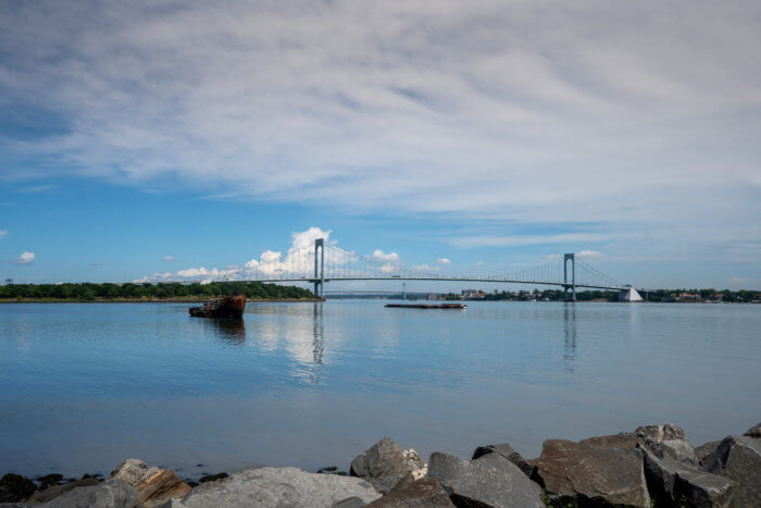
New York City’s waterfronts are a prime hot spot for the borough’s summer enthusiasts. But for Bronx residents, access to the city’s waterfronts and shorelines is a hassle, with certain landlocked communities more than an hour removed from waterway access.
While more than 90% of Manhattan residents within a half-mile of the waterfront have formal access to a waterfront park or open space, fewer than half of Bronx residents within a half-mile can access their waterfronts, according to a new report by the city Department of City Planning (DCP).
Using detailed walkability and transit analyses, the report found nearly three million New Yorkers live within a half-mile of the waterfront and that approximately two million of them live within walking distance of a waterfront park or open space. However, roughly 800,000 people, do not. The report also found that more than 80% of the city’s 8.5 million residents are just a 30-minute bus or subway ride away from the waterfront.
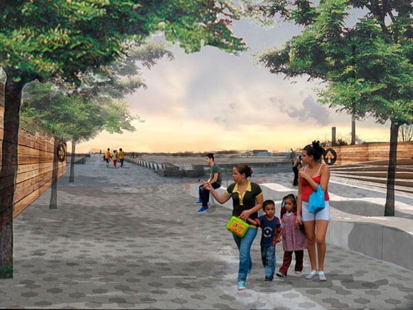
City planning officials hope that a new mapping tool will provide users access points and information on NYC’s waterfront communities, with special attention to areas of waterfronts that have limited access. While new parks and crossings along the Bronx River have made Bronx waterfronts more accessible to the community, city planning officials say that most waterfront residents in the Bronx do not have direct access to the waterfront within a half-mile walk of their homes.
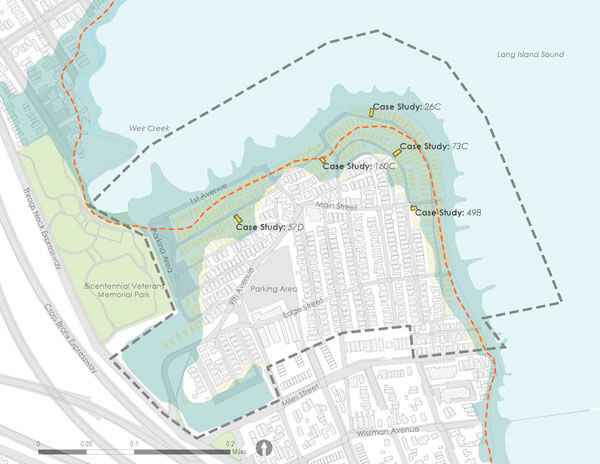
The sections of West Farms, Bronxdale and Wakefield are among some of the most landlocked communities in the borough with more than 1,000 residents without direct access to a local waterfront. Additionally, city planners suggested open space access can be found along industrial waterfronts such as the West Shore of Staten Island, East Williamsburg in Brooklyn, and Westchester Creek in the Bronx.
“As the stewards of much of New York City’s diverse waterfront — from natural areas to beaches to esplanades — we understand the importance of expanding and promoting equitable waterfront access for all New Yorkers,” said NYC Parks Commissioner Sue Donoghue. “We applaud the Department of City Planning for developing this user-friendly map and publishing this thoughtful analysis supportive of efforts to connect residents to their open spaces along the waterfront.”
Opening access to NYC’s waterfront wonder has been a consistent effort by the city planning officials, as they announced in December a 10-year vision — the Comprehensive Waterfront Plan — to provide more equitable access for the 520 miles of waterfront citywide. The plan is organized by a framework of six topic areas and presents ways city agencies can collaborate with waterfront communities and other stakeholders. The six major topic areas are climate adaptation and resiliency; waterfront public access; economic opportunity; water quality and natural resources; ferries and governance.
When Hurricane Sandy decimated New York and New Jersey’s coastlines in 2012, it cost an estimated $19 billion in damages and economic losses, but also led to the revamping of the city’s approach to waterfront land use. The December plan noted the need for city officials to make land-use policies with climate resiliency and risk as well as resilient design as New York City’s shorelines could be further imperiled by rising sea levels in the coming years.
Waterfronts and shorelines are not only a recreational and co-habilitative bonus to a community, but they are often used as economic hubs. Under the city’s waterfront plan, the city cites the Hunts Point Food Distribution Center as an example of spaces that city officials can continue to invest in to further reactivate or modernize those spaces.
After Sandy dealt NYC shorelines unprecedented heavy flooding, the city made efforts to rebuild its waterfront communities thorough a flurry of initiatives.
In the past decade, the Bronx shoreline has seen added recreational and industrial access and partial restoration efforts of its natural habitats, and activity has also increased on Bronx waterways with the Concrete Plant Park and Starlight Park projects, and the success of the Bronx ferry services.
Should the Bronx get another ferry stop? City Islanders think so, but EDC has no plans
“New York City’s waterfront is one of our best assets – a source of fun, relaxation, transportation, work, and much more. Every New Yorker should be able to reach and enjoy our shoreline and experience all it has to offer. This map and report lay out how people are accessing the waterfront, and how we can do even better. Both are important tools in our ongoing march towards a more equitable shoreline and city,” said DCP Director Dan Garodnick.
And once long-neglected by the real estate industry, waterfront development has also increased with the need for housing. In University Heights, Dynamic Star planted its flag on a 2.5 million-square-foot, 14-acre Fordham Landing project, which has 3,000 feet of frontage along the Harlem River.
Reach Robbie Sequeira at rsequeira@schnepsmedia.com or (718) 260-4599. For more coverage, follow us on Twitter, Facebook and Instagram @bronxtimes