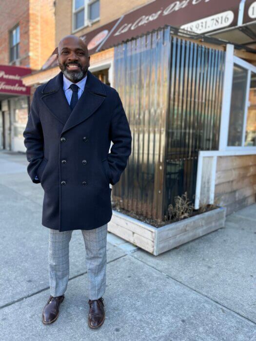
The chief duties of a typical city planner is to develop land use and zoning strategies. But engaging Bronxites on the rollout of two projects — the Metro-North expansion and the Cross Bronx feasibility study — is the main focus of Paul Philps.
Philps was hired as the NYC Department of City Planning’s new Bronx borough director in January.
The Metro-North expansion plans, a proposal by the city’s zoning initiative, “City of YES,” to “bring holistic planning and new infrastructure investments” in conjunction with the construction of four Metro-North stations mostly situated in the East Bronx, is scheduled to begin the public review process later this summer
In April, Bronx residents will also get a chance to provide their input on the city’s upcoming Cross Bronx Expressway feasibility study, kicking off a summer outreach campaign by city officials to uncover the harms and explore the needs of communities affected by the highway through public comment.
“There’s a lot of misconception about what we do as an agency, so it’s really to our benefit that we make sure we’re engaging with the community. It’s important to what we do,” said Philps, a former Bronx Community Board 4 district manager who had a hand in the Jerome Avenue rezoning. “Land use and zoning is a powerful tool that we use to unlock development potential, but it also creates an opportunity for job growth and economic development. It’s a tool that we know has a lot of power, and we want to utilize it in the best way to serve the Bronx.”
New Metro-North stations
The Metro-North Penn Station Access Project will transform Amtrak’s Hell Gate Line from two to four tracks in the East Bronx and Westchester County. The line will then connect the New Haven line in New Rochelle to the new Bronx Metro-North stations, before ending up at Penn Station.
The stations are expected to open in 2027, but city planners are prepping for the next stage of the project, land use changes that compliment the project. In the second half of 2023, land use recommendations are expected to enter a formal public review process.
Philps said that city planners are working with the city Department of Transportation and other city agencies on future plans for public realm improvements as well as in-the-works job growth plans with the The Mayor’s Office of Talent and Workforce Development to accompany the new stations.
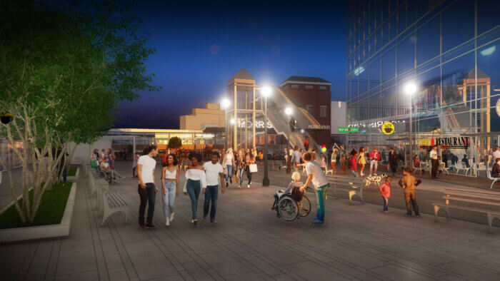
Zoning actions are focused on a 46-block area of Parkchester/Van Nest and Morris Park, primarily along the main corridors of East Tremont Avenue, White Plains Road, Bronxdale Avenue, Eastchester Road and Stillwell Avenue; and near the two neighborhoods’ future Metro-North stations in Bronx Community Districts 9, 10 and 11.
In addition to 10,000 new jobs, one of the commitments of the plan is the creation of 6,000 new homes, with at-least one quarter of them income-restricted under the city’s Mandatory Inclusionary Housing program.
Morris Park’s station is sited in the borough’s largest job center— with 12% of the borough workforce and more than 23,000 jobs within a half-mile of the proposed station — near Montefiore Medical Center, Albert Einstein College of Medicine, Jacobi Hospital, Hutchinson Metro Center and the Bronx Psychiatric Center.
Similar visions are in place for the Hunts Points location, another major job hub in the borough that increasingly grapples with road congestion, with a station sited across Del Valle Square.
Co-op City’s planned station is the farthest from downtown Manhattan, and provides transit-starved City Island and Pelham Bay Park residents access to the southern parts of the borough and a connection to Orchard Beach.
The Parkchester/Van Nest locations hope to create a more walkable neighborhood, particularly alongside East Tremont Avenue — where sidewalks and pedestrian space are lacking. One land use opportunity planners cite is de-mapping part of two city streets to expand the existing Van Nest Park.
A major benefit for Manhattan-bound Bronx commuters is that commutes through existing MTA lines to Penn Station that take an hour or longer will now be cut down significantly. According to MTA officials, average travel times will be reduced to 16 minutes from Hunts Point, 20 minutes from Parkchester, and 25-28 minutes from Morris Park and Co-op City stations.

Studying the Cross Bronx Expressway
Given the volume and variance of communities that are affected and impacted by the Cross Bronx Expressway, Philp knows that there’s no “one size fits all” solution for the future of the expressway.
In December, Mayor Eric Adams announced that his administration would begin reassessing the negative impacts posed by the Cross Bronx with a new $2 million federal grant — which the city acquired from the U.S. Department of Transportation through its Rebuilding American Infrastructure with Sustainability and Equity grant program.
City officials expect the study to develop into a plan that addresses highway-fueled public health issues by 2024.
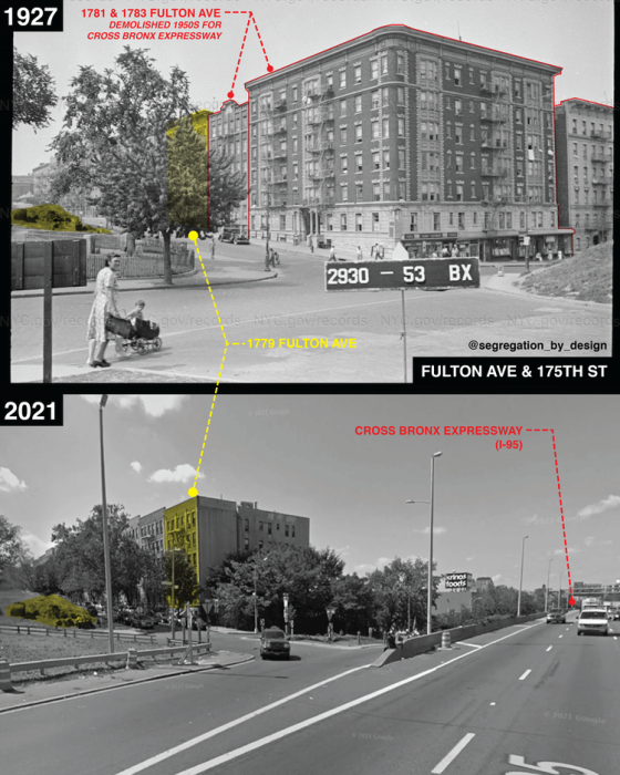
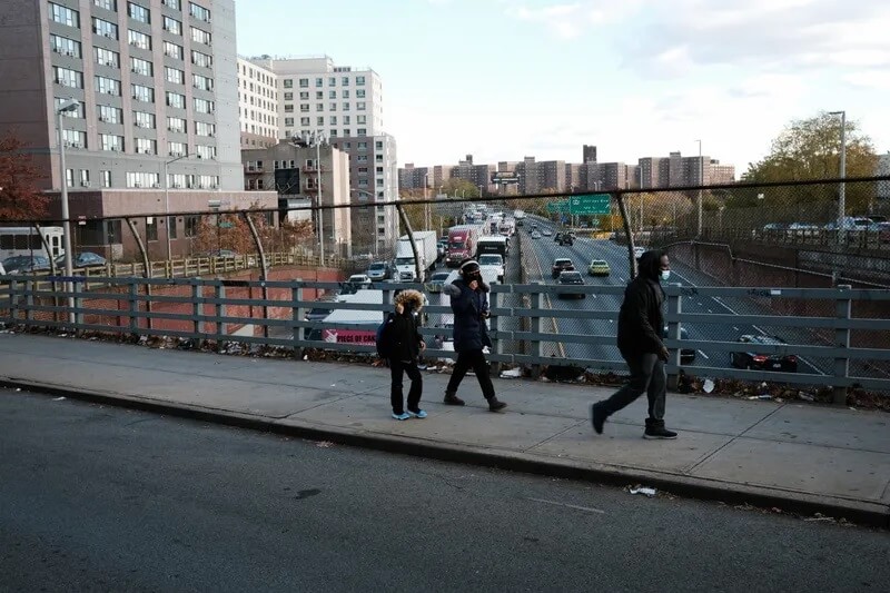
The Cross Bronx Expressway was started by urban planner Robert Moses in 1948, and has long been criticized as a project rooted in environmental racism: The highway divides the borough in half and originally displaced entire neighborhoods — many of which were predominantly Black, brown and immigrant communities — upending the homes of approximately 40,000 Bronxites during its construction.
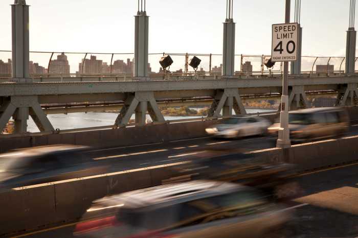
The highway’s congested lanes, in addition to everyday noise and air pollution, has brought elevated asthma rates and other inequitable health outcomes to Bronxites living in the area. Chronic health conditions there, like diabetes and hypertension exceed citywide rates by up to 100% and 50%, respectively.
The expressway has also created an “asthma alley” in the borough, averaging more than 23,000 asthma-related emergency room visits per year.
And traffic on the Cross Bronx Expressway at Macombs Road could see a daily average increase of 4,000 additional personal vehicles and 704 additional trucks, according to the MTA — depending on the outcome of a congestion pricing proposal that would charge vehicles entering Manhattan south of 60th Street into or within the central business district of Manhattan. In recent years, residents and politicos have sought to cap the Cross Bronx Expressway, covering the highway with open, green spaces.
“In the next month or so, we’ll be doing a series of public events and engagements … and these events will be a listen and learn opportunity to hear from the community, how they’ve been affected and what are the hopes and desires for these communities,” said Philps. “There are a lot of different communities affected by (the Cross Bronx), and there isn’t a one size fits all approach to addressing the Cross Bronx’s future.”
Reach Robbie Sequeira at rsequeira@schnepsmedia.com or (718) 260-4599. For more coverage, follow us on Twitter, Facebook and Instagram @bronxtimes.